Customer Portal
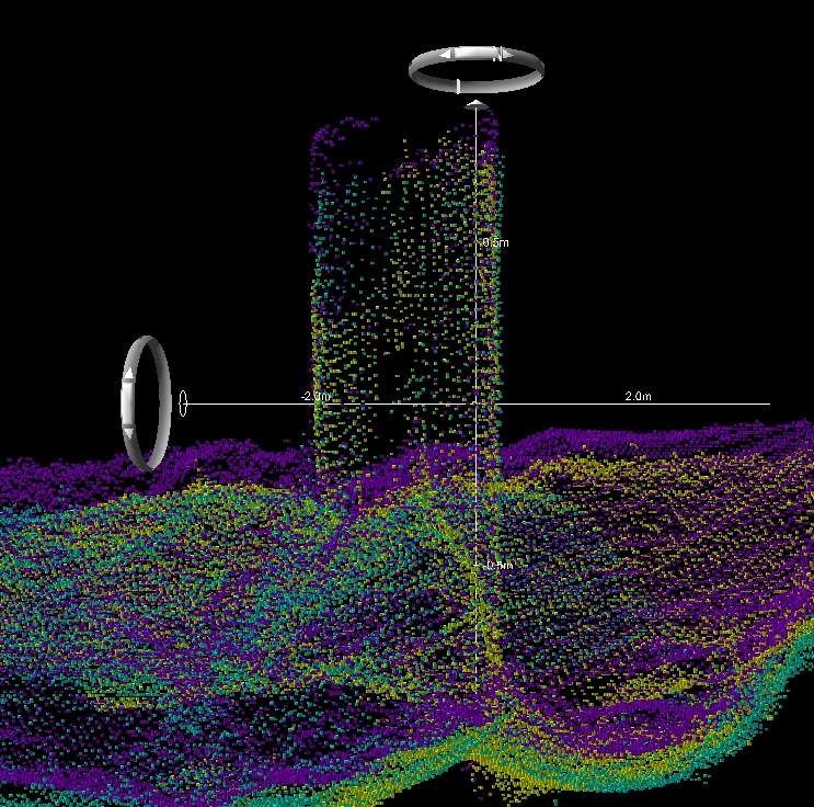
NOTE: The advances made in Satellite-Based Augmentation Systems (SBAS) since this article first appeared in 2012 make the title inaccurate. A more appropriate title today is “Stop Using Decimetric+ Positioning!” The reader must be aware that most references to SBAS accuracies within the article are out-of-date.
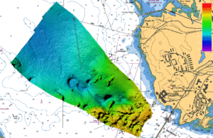
For surveyors, accuracy is everything. Which is why shallow water high-resolution multibeam echosounder (MBES) surveys should not be conducted where the uncertainty of the horizontal positioning system is larger than the nadir footprint of the MBES at the mean survey depth.
In depths of 100 meters, the horizontal component of the nadir footprint of a 0.5° x 1.0° multibeam sonar, is an ellipse whose minor axis is approximately 0.9 meters, and approximately 0.09 meters at 10 meters depth. Regardless of the International Hydrographic Organization (IHO) Special Order Specification that allows for non-centimetric level horizontal positioning, such as Differential GPS (DGPS), the results are unacceptable for high resolution shallow water surveys, especially where feature detection is a priority.
Consider the following two hydrographic survey scenarios, both occurring in less than 100 meters of water, both using a high resolution MBES. In Scenario One, the surveyor is using centimetric level positioning via Real Time Kinematic (RTK) or Post Processed Kinematic (PPK) GPS. In Scenario Two, the surveyor is using some form of sub-meter DGPS or SBAS. If you were to ask both surveyors why they chose the positioning system that they did, both would almost certainly touch upon a cost-benefit analysis that they considered relating to the vertical component of GPS. Surveyor one would discuss the advantages of not having to worry about squat, static draft and water levels whereas surveyor two would likely state that the added cost of centimetric (vertical) positioning was not justified as water levels and/or draft were not difficult to obtain and accurately measure. It is highly likely that neither surveyor considered the horizontal component of a centimetric positioning system in their analyses because of the mindset that labels centimetric positioning to be a “Z” value only product.
The centimetric level positioning is not just for those surveys where the Z component of the GNSS solution is desired. Any high resolution MBES survey in 100m or less of water should use centimetric X and Y positioning regardless of whether the Z component is being calculated from water levels or GNSS.
Simply stated, high resolution surveys demand horizontal positioning whose uncertainty is less than or equal to the footprint size of the MBES nadir beam. Using a positioning system whose accuracy exceeds this can result in poor patch test results, poor feature detection, or more frankly, a low-quality survey.
IHO Special Order Accuracy allows for a Total Horizontal Uncertainty (THU) of 2 meters. Clearly this specification opens the accuracy flood-gates in order to let DGPS positioning in, with the remaining horizontal components of other equipment contributing very little to the overall THU. When using the latest generation of high resolution multibeam echosounders for high-resolution (Special Order) surveys, DGPS should not be used.